Motukauri Island
In 1960, Bill & Dorothy Ward purchased Motukauri Island, situated in the Whangaruru Harbour. It is around 6 hectares in size and one of three islands in the Bay of Islands region with the same name – in fact according to the NZGB Gazetteer, the name of this island is not official, though it has since been designated a scenic reserve with the name Motu Kauri Scenic Reserve. The island is not labelled on Google Maps, though it is named on New Zealand nautical charts and topo maps.
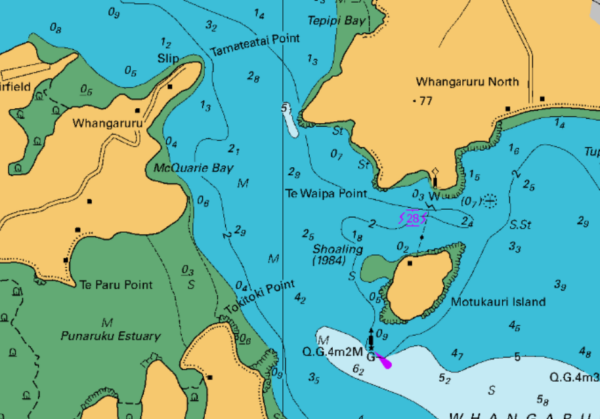
Nautical chart showing Whangaruru Harbour with Motukauri Island and Tamateatai Point. The hydrographic raster data made available through the LINZ Data Service is based on the Paper Navigational Charts published and maintained by the New Zealand Hydrographic Authority at Toitū Te Whenua Land Information New Zealand (LINZ).
The island had belonged Arthur and Rachel Darrington since 1952. Rachel Darrington (nee Webber) was the sister of Dot’s close friend Phyllis Evans. Bill, being a risk taker and entrepreneur, thought it sounded like a good idea to buy it, though Dot was not so convinced. In the end she gave in and they purchased it for £12,000.
Bill stocked the island with sheep and planted vegetables for the table. The Ward family and friends travelled back and forth from Auckland (about a five hour drive north) for frequent holidays in the existing small house up the hill.
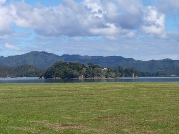
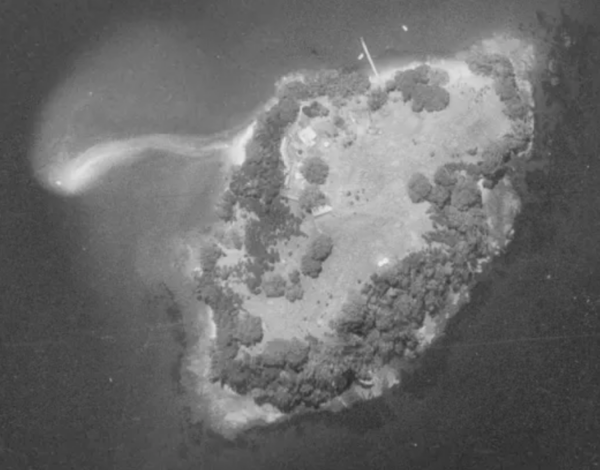
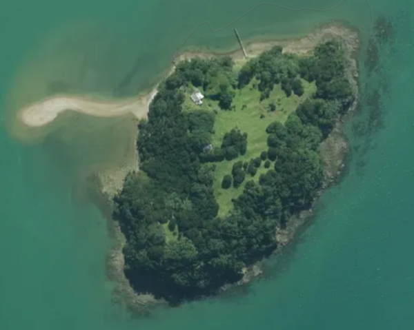
Motukauri Island photographed from Whangaruru North by Sally Smith in 2012.
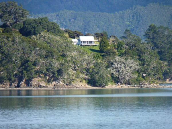
The holiday house where the family stayed on The Island, photographed in 2012 by Sally Smith.
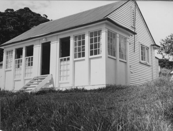
The holiday house as it looked in the 1960’s.
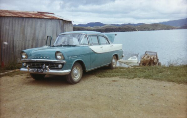
Bill Ward owned a tin shed at Whangaruru (Tamateatai Point), where he kept a dinghy with an outboard motor, used to ferry passengers, sheep and supplies from the mainland to the island. The trip took about three quarters of an hour. There was no jetty at that time so they landed the dinghy directly onto the beach (where the jetty is located now in the image above).
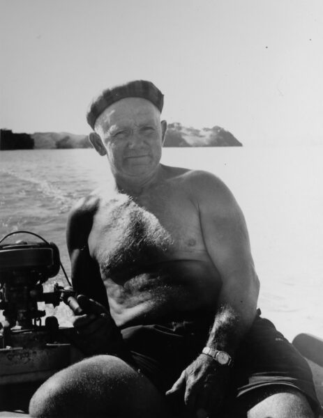
Bill Ward in his outboard powered dinghy heading to the island.
A trailer of sheep being loaded into the dinghy to be transported to the island. The old tin shed where the dinghy was kept is seen on the left.
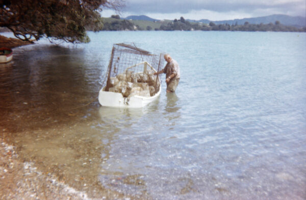
Sheep loaded into Bill Ward’s dinghy ready for the trip to the island.
© CC BY 4.0 Toitū Te Whenua Land Information New Zealand, Ministry of Primary Industries – Northland 0.375m SN5932 (1981-1982)
© CC BY 4.0 National Institute of Water and Atmospheric Research – Northland 0.3m Rural Aerial Photos (2023-2025)
Facilities were very basic for those summer holidays, with limited power from a generator but otherwise a wood and coal stove was used for cooking and kerosene lamps for lighting. The house was one big room that was divided off by curtains to make smaller rooms for guests. There was one detached sleep out and an outhouse for a toilet. All washing was done using plastic bowls.
It was sold in 1968 for $20,000.
In 1994 the land was held by the crown for conservation purposes, then in 2007 it was officially designated a scenic reserve called “Motu Kauri Scenic Reserve”, administered by the Ngatiwai Trust Board.